How have the drones optimised how we work?

Just how useful has drone technology been to various industrial applications?
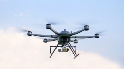
We do know how military grade drones have changed and are continuing to change the face of warfare forever. But we do not really care about military drone technology here; our focus is on using drones for good. You know; applying chemicals to crops in the fields; delivering medicines, inspecting the power grid; looking out for criminals at business premises; and doing those jobs that are unsafe for human do physically carry out.
So the question of how the drones have been beneficial for civilian applications is indeed a valid one. Otherwise, we’d be just here, writing this for the wind, rooting for a technology that has no fanbase and no positive effective on society.
Research experts at Drone Industry Insights recently sought to answer this question, and they produced the below report, which we hope will answer some of your own questions.
Enjoy.
In today’s rapidly evolving world, the use of drones has revolutionised various industries, offering innovative and efficient solutions to complex tasks. From capturing breath-taking aerial images to delivering packages with precision, drones have become indispensable in diverse terrains and contexts.
The term “drone application method” simplifies the description of their utilisation, allowing us to categorise their uses into distinct groups. Whether it’s through sensing methods like photography and surveying or action-oriented interactions like spraying and delivery, drones have proven their versatility and effectiveness.
By exploring these application methods, we gain valuable insights into the remarkable capabilities of drones and their impact on different industry verticals.
Application Methods: The Use of Drones for Work
As the infographic above shows, drones can be used in all types of terrains and contexts to carry out tasks more efficiently than a human or other machines.
“Drone application method” may sound like heavy jargon, but it helps avoid long formulations such as “the use of drones for photographing sites” (application method: photography) or “drone use for surveying land” (application method: surveying).
And although there can be a myriad of highly-specific terms to describe what drones do (e.g. monitor, survey, spray, drop, collect, dispense, etc.), the majority of drone uses can be grouped and structured as described in the following paragraphs.
One category of drone uses is made up of sensing methods, where data is recorded by the drone without any physical contact with other objects.
The most well-known of these is Photography and Filming, which involves the aerial use of cameras to capture images and for the production of aerial videos.
Meanwhile, Mapping and Surveying is focused on creating a simple or very accurate representation of a given area to study or measure altitudes, angles, distances.
Inspection entails the examination of a given object to find faults, errors, malfunctions or other specific phenomena that might affect the functioning of it.
Finally in this group, Localization and Tracking is used to observe, seek and supply the geographical coordinates of activities, persons or life-stock, or detecting certain activities.
Another category to classify the use of drones is action/interaction methods. Most prominently in this category, we find two types.
Spraying and Dispensing is defined as the aerial distribution of solids (e.g. fertilizer or seeds), or the process of spreading liquid substances (e.g. water, insecticide or fertilizer).
The second and more talked about method is Delivery, which is of course the transportation of packages, food, pharmacies, or other goods either on demand or according to a given schedule.
Within these two groupings, we can nevertheless create “Other methods” such as warehousing, measuring, contact sensing, illuminating, or transmitting. These application methods would fit less neatly into the sub-categories above but are still relatively common drone uses throughout the industry. With all of this said, it is time to turn our attention from specific drone application methods to industry verticals as a whole.
Industry Verticals: Drone Use Within Industries
When we talk about drone use for Construction, there is a lot that they could actually be doing, such as for example: drones can carry out aerial imagery for site planning, management and communication (photography & filming method); they can also survey construction sites and produce topographic surveys or 3D reconstructions (mapping & surveying method); and we also often see the use of drones for monitoring construction sites to avoid illegal trespassing or thefts of site assets or supplies (localization & tracking method).
Similarly for drones in Agriculture, where they could identify/locate dead, hurt, or sick animals (inspection method in the animal production sub-vertical), or spray crops with pesticides or insecticides (dispensing & spraying method in crop production sub-vertical), or carry out forest inventory and crop health monitoring (mapping & surveying method in the forestry sub-vertical).
Our infographic shows, for example, that the Inspection method is most common in Energy, Transportation, and Mining among other industries. Alternatively looking at the various methods described, we could derive that in the Agriculture industry the use of drones is often for Spraying & Dispensing, Mapping & Surveying, and sometimes Localization & Tracking.
Application Report: Data on the Commercial Use of Drones
Drones have undeniably transformed industries, offering unparalleled efficiency and innovation. From capturing stunning aerial imagery to precise package delivery, drone use is far-reaching. Sensing methods like photography, surveying, and inspection enable data collection without physical contact, while action-oriented methods like spraying, dispensing, and delivery showcase their dynamic capabilities.
Our latest Drone Application Report delves deeper into the advancements in the use of drone technology, featuring 264 application examples and 85 real-life case studies from companies around the world. In short, the integration of drones has undoubtedly reshaped industries, and there is much more to discover as highly-awaited regulations take effect and we embrace the future of this transformative technology.


0 Comments